

Spain is sculpted by extensive mountain ranges surrounding a high inland plateau and has nearly 6000km (3728 miles) of coastline. This extraordinary geographic interplay means that hikers can enjoy staggering natural tableaus along their routes, featuring rugged cliff edges, granite rock formations, snowcapped mountains, rushing rivers, glacial lakes, deep canyons and turquoise-colored waters fringed by white sand beaches.
Spain’s rich cultural heritage also means that hikers are treated to ancient ruins, historical towns, old churches and even random castles along the way. Here is a rundown of emblematic hiking routes that show off the incredibly diverse beauty of this Iberian destination.
Explore the planet’s most surprising adventures with our weekly newsletter delivered to your inbox. 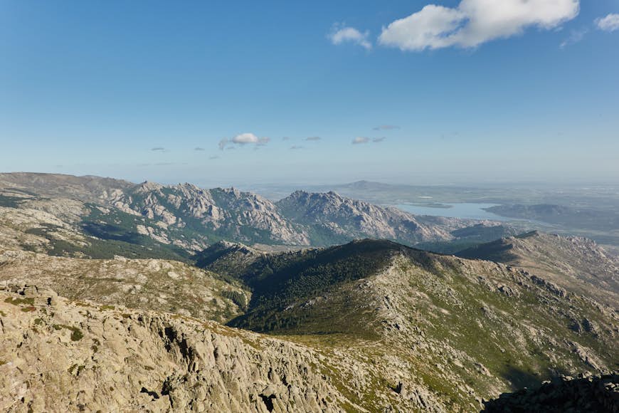 Sierra de Guadarrama National Park is only about an hour from Madrid © JaviJ / Getty Images
Peñalara
Best hike for viewing glacial lakes
14km (8.7 miles), 4 hours, intermediate
Just about an hour’s drive from Madrid is the Sierra de Guadarrama mountain range, which forms the spectacular backdrop of the Spanish capital’s most popular hiking routes. One of the most well-loved trails is the Peñalara circular route, which is accessed via the Puerto de Cotos pass in the mountain town of Rascafría.
This intermediate-level trek will take you to the peak of Peñalara, Madrid’s highest summit at 2428m (7966ft), and will slowly reveal its wondrous natural landmarks — amphitheater-like valleys and glacial lakes, formed by millions of years of glacial erosion. Laguna Grande (Big Lagoon), Lagunas de los Claveles (Lagoons of the Carnations) and Laguna Chica (Small Lagoon) are the trail’s three prominent lakes, which make up part of the Sierra de Guadarrama National Park.
Discover the Caminito del Rey, Spain
El Caminito del Rey
Best steep trail with archaeological highlights
8km (1.9 miles), 2.5 hours, easy
Translated to “The King’s Little Path” after King Alfonso XIII’s visit in 1921, this top tourist attraction in the southern Spanish city of Málaga is not for the vertigo-challenged. The trek takes you on a long, wooden bridge affixed on the jagged steep walls of the Gaitanes Gorge. Historically, this was used as a service route for the upkeep of the El Chorro hydroelectric plant and was once dubbed “the scariest walk in the world.” Thankfully, recent renovations have reinforced the walkway with protective steel fencing.
This is an easy, non-ascending trek that nevertheless rewards with spellbinding views of the emerald green waters of the Guadalhorce River below. Along the way, you’ll encounter archeological marvels like Neolithic caves dating back 7000 years and Jurassic-era fossils embedded on the gorge walls. Its official website offers general visit tickets for hikers who wish to do the trek independently, but for an extra cost, you could avail of a guide who could share about the Caminito’s unique history and geological story.
 La Pedriza passes alpine lakes and rugged granite formations © Pere Ramon / Getty Images
La Pedriza
Best hike for rugged mountains
12km (7.5 miles), 3 hours, intermediate
The La Pedriza trail starts right at the town of Manzanares El Real, about 50km (31 miles) from central Madrid, situated close to the Manzanares upper river basin and on the southern edge of the Sierra de Guadarrama. This is part of a Unesco Biosphere Reserve that is characterized by rugged granite formations grazed by gentle streams and churning waterfalls. The most famous pool, Charca Verde (“Green Pool”) is so named for its deep emerald hue. Rising over 1700m (5577ft), the peak of El Yelmo (“The Helmet”) is La Pedriza’s highest summit and dominant landmark. While you’re here, you should take time to visit the Castillo de los Mendoza, a 15th-century stone castle.
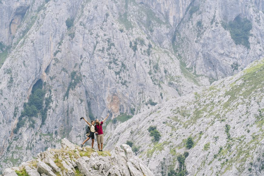 The Cares Trail is considered one of the most beautiful hikes in Spain © Westend61 / Getty Images
Cares Trail (Picos de Europa National Park)
Best hike for dramatic scenery
21.9 km, 6.5 hours, intermediate
Towering high above northern Spain are the iconic, cloud-grazing Picos de Europa (“Peaks of Europe”) that encompass Asturias, Cantabria and Castilla y León, offering some of Europe’s most breathtaking mountain views. These limestone summits form the dramatic setting of the Cares Trail, the most popular and emblematic route in the Picos de Europa National Park.
Also known as La Garganta Divina (“The Divine Gorge”), the Cares Trail is a moderate route that was initially carved into the limestone in 1916 to make way for workers maintaining a water canal that powered the Camarmeña Power Plant in Asturias. Presently, this route is considered to be one of the most beautiful in Spain, as you zigzag along plunging ravines (again, this not for people afraid of heights), caged bridges and walkways connecting the jagged mountain faces, with spectacular views of the Cares River below and mountains rising 2000m (6562ft). Even non-advanced hikers can enjoy this leisurely experience if they start in the quaint mountain village of Caín de Valdeón in the province of León, which eventually progresses downhill.
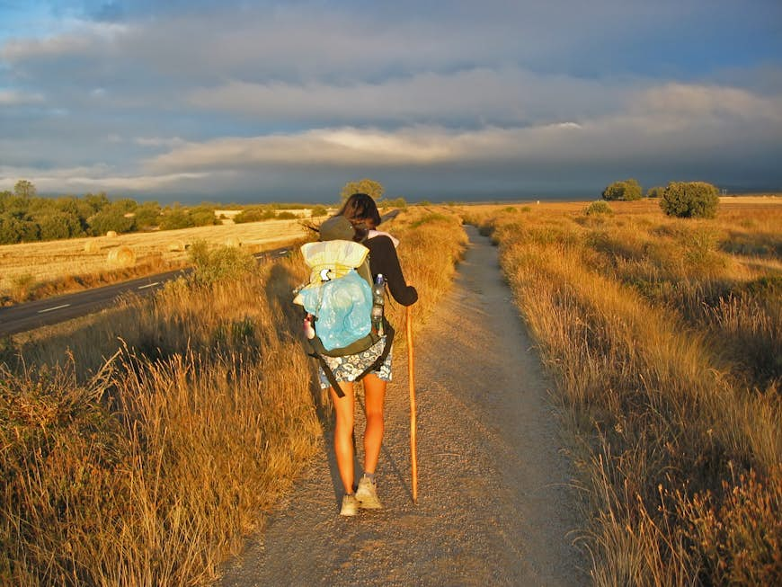 Embarking on a pilgrimage is a great way to see Spain and meet fellow travelers © iburek / Getty Images
Camino de Santiago (French Way)
Best historic hike to retrace pilgrims’ footsteps
100km (62 miles), 7 days, intermediate to difficult
Follow in the footsteps of 8th-century pilgrims who have walked this 500-mile stretch of northern Spain. For ten centuries, this tradition has attracted not only spiritual trekkers but nature lovers and sports enthusiasts of all levels because of its majestic scenery. The route takes you from the Pyrenees mountains straddling the border between Spain and France, across rugged coastlines, lush forests, traditional villages and vineyards, and finally to the Basilica of Santiago de Compostela in the capital of Galicia, where Saint James the Apostle is believed to be buried.
Traditionally, the Camino de Santiago starts in the town of Saint Jean Pied de Port in the Pyrenees in southwest France, which is the most popular route, but many pilgrims also choose to begin in the Galician town of Sarria to be able to walk the final 100km (62 miles) stretch of the French Way and get their pilgrim passports stamped. This multiple-day trail will take you through the small towns of Portomarín, Melide, and Arzúa, across the Miño River — Galicia’s longest river — picturesque woods and Romanesque churches. After accomplishing a day’s hike, it is a longstanding tradition to mingle with fellow pilgrims, most likely while drinking albariño (traditional Galician wine) before getting a good night’s rest.