
The roads around Yosemite National Park are a driving utopia – and motorists have 19th-century pioneers to thank.
Early explorers had the gusto to carve these routes through expansive backcountry, sublime valleys, and pretty meadows, where deep gorges are dotted with emerald-green forests, shimmering lakes, and ancient sequoias. It’s now unfathomably easy to access untamed wildlife and dazzling High Sierras scenery on a number of superbly maintained routes – all you need is a vehicle and a sense of adventure.
Alas, the world is fully aware of this driving wonderland and it can become frustratingly clogged up at peak times. Read on for tips on how to avoid the crowds and enjoy an epic drive to yourself with our five best drives in and around Yosemite.
Get trusted guidance to the world’s most breathtaking experiences delivered to your inbox weekly with our email newsletter.
1. Tioga Road
Best route through Yosemite
Crane Flat to Mono Lake; 60 miles (96km); 2–4 hours
Easily one of California’s best drives, this is the highest highway pass in California reaching a dizzying 9945ft (3031m) at its apex and bisecting Yosemite National Park between its eastern and western borders. Closed in winter due to snowfall, it reopens for summer and fall and cruises through the Sierra Nevada mountains, first winding past the giant sequoias of Tuolumne Grove and then climbing up to evergreen forests and viewpoints, with Tenaya Canyon and the back side of Half Dome in the distance.
Further on the route, the shimmering Tenaya Lake begs drivers to stop and dive in. Stretch the legs at nearby Cloud’s Rest trail, ending on a palm-sweatingly narrow ridge with 360-degree views. Tuolumne Meadows teems with wildflowers in spring, and the Lembert Dome hike is a short but mighty challenge up a granite dome rock.
At the road’s highest point, Tioga Pass (serving as the entry point to Yosemite from the east side), Mt Dana looms to the east as you exit the park. Pass the twinkling high-altitude lakes of Tioga and Ellery, before the final descent to the hauntingly beautiful Mono Lake with its outdoor gallery of other-worldly tufa towers. Chances are you’ll immediately want to U-turn and ride this road all over again.
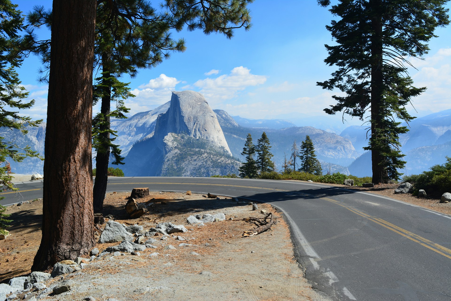
 Build in plenty of time en route to enjoy Yosemite’s waterfalls, forests and peaks © Alex Eggermont / Getty Images
2. Yosemite Valley Loop
Best road trip for less-confident drivers
El Capitan Meadow to El Capitan Meadow; 14 miles (22km); around 40 minutes
One of the shortest drives in the area, but no less punch-packing, is this nature cruise through the beating heart of Yosemite National Park, with roads clasped by geological masterpieces. The atmospheric one-way loop can be conquered by both private vehicle and shuttle bus if you don’t feel like driving at all. Snaking east along the Merced River under canopies, clearings in the dense trees reveal astonishing views of the towering Yosemite Falls, plus the iconic El Capitan and Half Dome formations.
It’s a humbling experience, as cars appear like fleas among the gargantuan granite behemoths and boulder-strewn landscape. Cypress, pine, hemlock, and fir trees line the roads – keep the windows down to breathe in fragrant forest aromas and listen out for the drum of a woodpecker or the distant roar of a black bear. At dusk, scenes turn to moody shadows and silhouettes in the big blue sky. Sleep under a carpet of stars at the North and Upper Pines Campgrounds, at the most easterly point of the route.
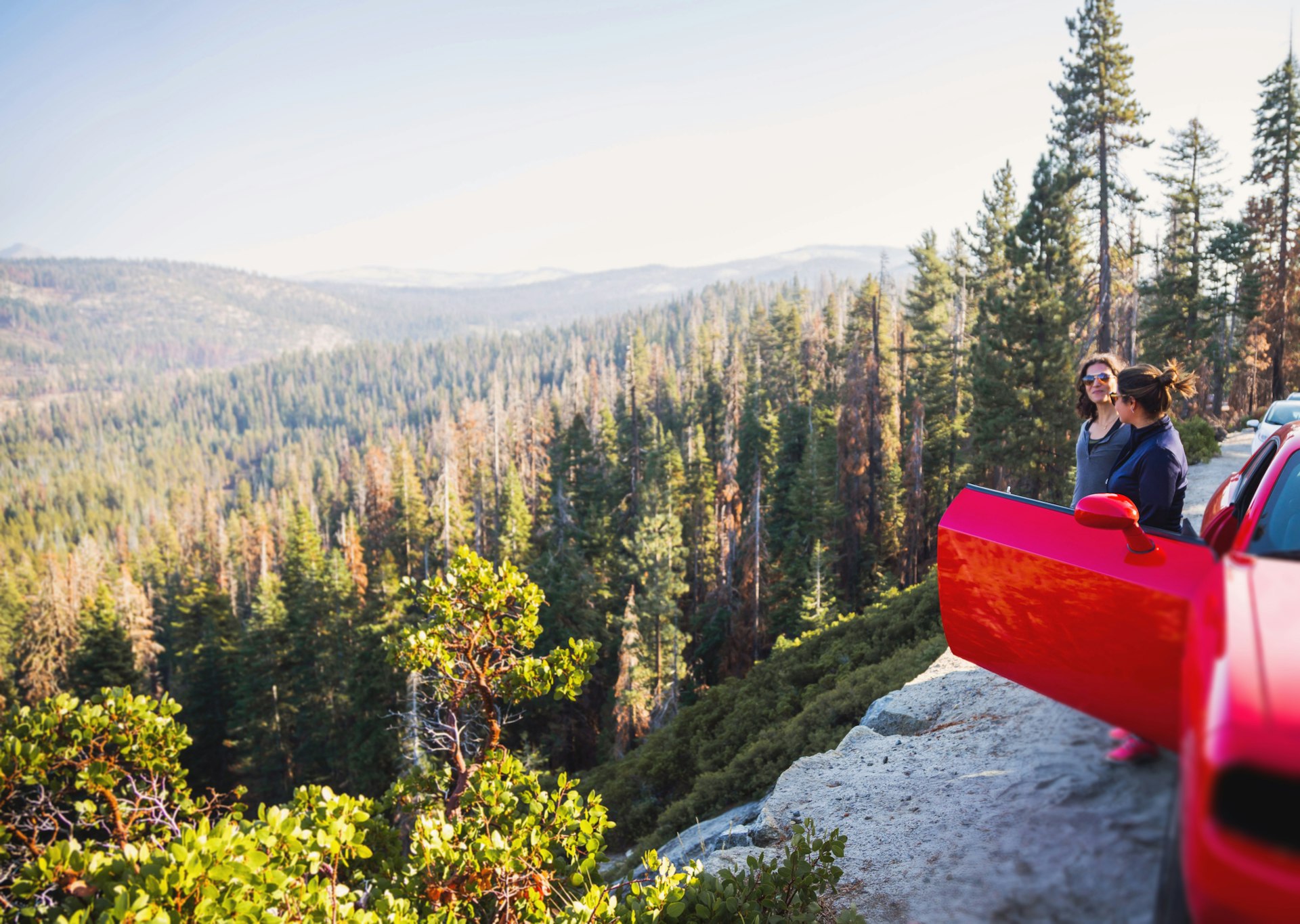
 Glacier Point Road offers classic sweeping Yosemite views © Matthias Hagner / Getty Images
3. Glacier Point Road
Best scenic drive with expansive views
Tunnel View to Big Tree Lodge; 52 miles (83km); 2 hours
The drive begins at Tunnel View scenic viewpoint with sweeping views of Yosemite Valley’s big attractions – Half Dome front and center and the all-encompassing 3000ft-high (914m) El Capitan to the left – often with climbers dangling like spiders – and opposite Bridalveil Fall, which plunges 620ft (188m) over a glacially-carved granite cliff. At the end of Wawona Tunnel – the longest highway tunnel in California at 4200ft (1290m) – the Turtleback Dome (5300ft/1615m) appears in view.
At the Chinquapin junction, the ascent up Glacier Point Rd begins. This 16-mile winding road is flanked by green forests and towering views of Merced Canyon below. In winter the Yosemite Ski and Snowboard Area is as far as you can go on this road. The route re-opens when the snow has melted in May or June, continuing to the crowd-pleasing (and easy) Sentinel Dome (8122ft/2476m) hike.
The best views from your vehicle are yet to come at Washburn Point – named after the Washburn brothers, who built the first road from Wawona to Yosemite Valley – with views of nature’s “giant staircase” Nevada and Vernal waterfalls. Further ahead is the road’s namesake – Glacier Point, with commanding views of Yosemite’s high country, Yosemite Valley, Half Dome and Yosemite Falls. Double back for 12 miles to cross the Merced River and finish at the historic Victorian-era Wawona Hotel.
Note: This road was closed for repairs at the start of 2023, check its status online ahead of your drive.
 Find peaceful spots of deep forest in Yosemite © Artur Debat / Getty Images
4. Ebbetts Pass Scenic Byway
Best for adventure
Topaz Lake to Yosemite Valley; 175 miles (281km) one way; 3–4 hours
To the north of Yosemite’s boundaries, in the Stanislaus National Forest is a monumental road trip through High Sierras country, with glacially carved valleys, giant sequoias, pristine lakes, little hamlets and the occasional bald eagle swooping overhead. Named after pioneer John Ebbetts, this road was earmarked as a “route of great promise” for the Transcontinental Railway. The railroad never happened, but a stage road was constructed to serve Silver City, and the miners working here were frequently treated to stellar views as they passed.
The drive starts in the east on the California–Nevada border at Topaz Lake – popular with boaters, water-skiers, campers, and fishers – before turning onto the boulder-flanked Route 89, cruising through arid desert-scapes and winding to greener pastures when meeting State Route 4. The crossing point for hikers on the legendary Pacific Crest Trail, a hiking trail spanning 2650 miles (4270km) from Mexico to Canada, is up ahead. On the north side of the road on the entrance to the PCT trail, climb the boulder for 360-degree views of mountains, deep green forests, and the piercing blue Kinney Reservoir below. Views continue on the road as clearings in the trees reveal snippets of classic mountain scenes, likely snow-tipped at this altitude, even in summer.
Despite its name, Mosquito Lake is an oasis of calm with shimmering waters, trout fishing opportunities, and three campgrounds nearby. Intoxicating views of the Dardanelle formation Cape Horn Vista Point await three miles west (spot the “sleeping lion” and “elephant” formations in the distance). Giant sequoias dapple the Calaveras Big Trees State Park, and at Lake Alpine and Spicer Snow Park road trippers can stop to play in the snow, with cross-country skiing, dog sledding and snowmobiling (book a trip with Bear Valley Adventure). Continue on to the little mountain town of Arnold before snaking 70 miles along the east side of Yosemite National Park (on the CA-49 and CA-120) through farmlands and green pastures and into Yosemite Valley.
5. Sonora Pass
Best for crowd-free alpine cruising
Tenaya Lake to Sonora; 84 miles (135km) one-way; 2–3 hours
Just north of Yosemite National Park California’s second-highest road (after Tioga Road), Highway 108/Sonora Pass (9642ft/2939m), travels between the town of Sonora in the west and Bridgeport to the east. This means it’s often overlooked, despite the scenery being just as stunning. The big bonus? Far fewer vehicles. Come here to test your driving skills with a classic car or motorbike on the race-track-worthy corners and narrow, steep inclines, while enjoying pinch-yourself scenes.
The road sweeps through the Kennedy and Leavitt Meadows, pleated mountain vistas, granite rocks, and meandering rivers. Start in Yosemite at the glistening Tenaya Lake, heading towards the town of Lee Vining (where you can stock up on supplies and gas for the drive). Pass the otherworldly limestone oddities at Mono Lake, before heading north on Scenic Highway 395. Reaching the Inyo National Forest, swing a left onto Highway 108 and this alpine dream drive begins.
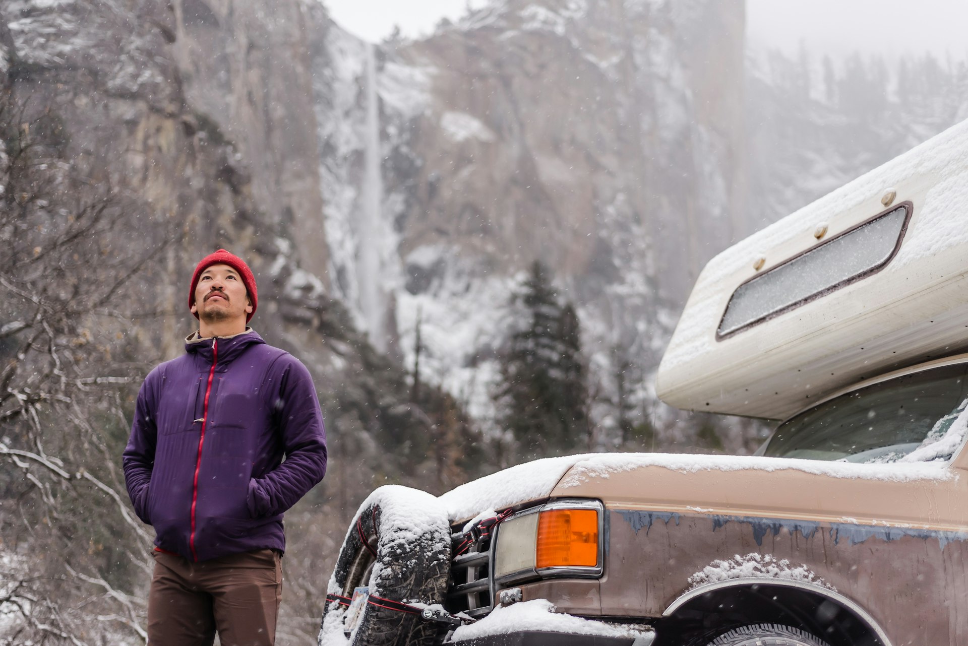
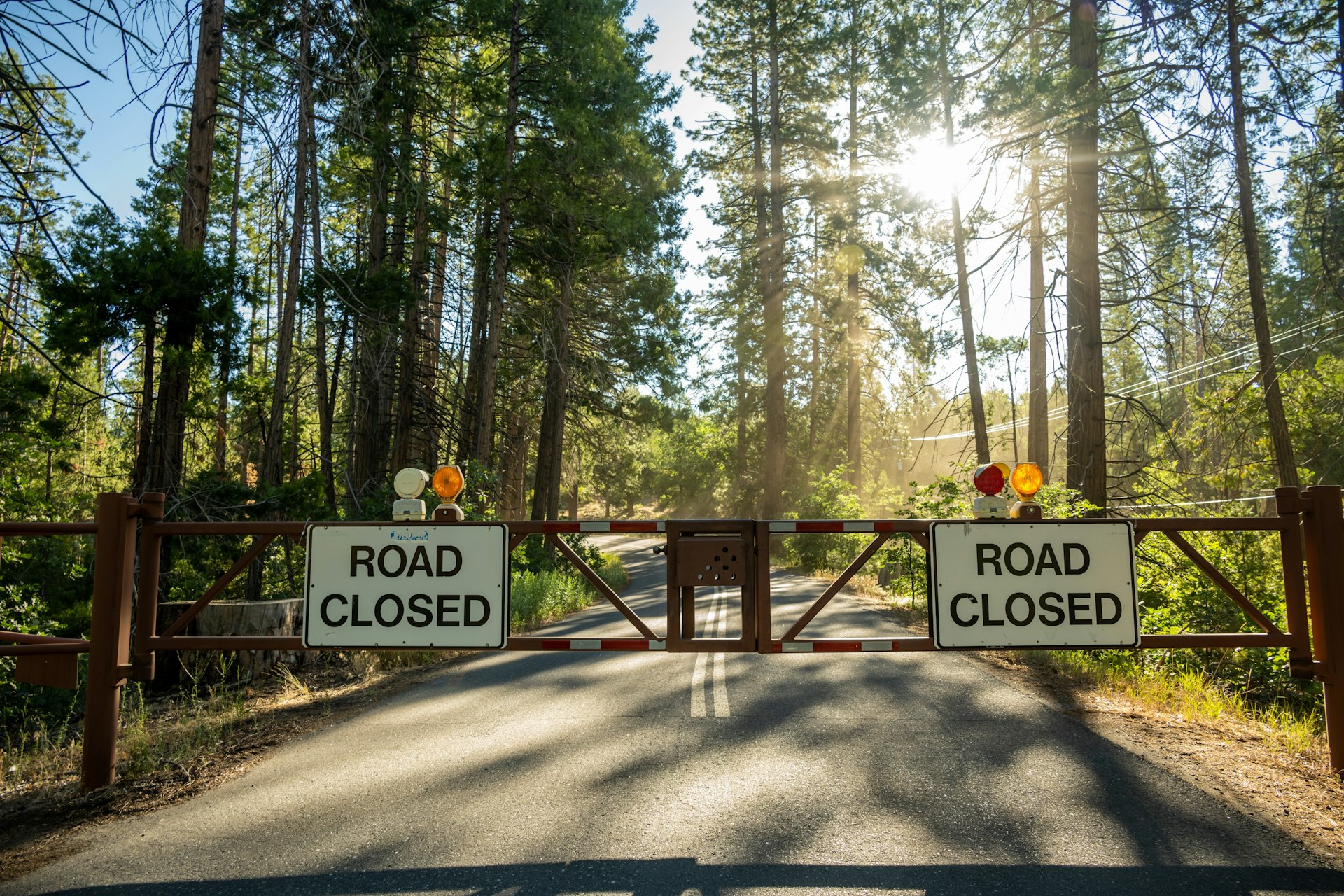 Check the status of roads in advance of setting out on a drive in Yosemite National Park © Kelly vanDellen / Shutterstock
Tips for driving in Yosemite National Park
- Drive at nonpeak times to avoid traffic. Avoid weekends, and holidays and opt for midweek early mornings inside the park. Where possible, take the shuttle around Yosemite Valley. Prepare for delays of an hour or more at park entrance stations. Parking spaces can be scarce.
- Check the status of the roads before you set off – many high-altitude roads are shut in the winter due to snowfall and are not plowed until spring. There is ongoing maintenance, so check at the visitors center or online for alerts before you set off.
- Be bear aware. Avoid leaving food in your car where possible in the daytime (if you must leave it in your car – keep it hidden from sight), and leave no food in your car overnight. Bears have been known to break into cars to find food, causing all kinds of damage to vehicles. Leave food in the bear lockers in parking areas and campsites.
- Fill up with gas before you enter the park. There are two gas stations in Yosemite National Park, but none in Yosemite Valley.