

Yosemite National Park is one of those dazzling, large-than-life destinations with a beauty that must be seen firsthand to truly appreciate it.
Renowned landscape photographer and environmentalist Ansel Adams did a good job introducing the public to this iconic park in the 1930s, when he began documenting its magic in black and white. Close to 100 years later, Yosemite remains an iconic photographic locale attracting close to five million visitors each year.
Scout new ways to explore the planet’s wildest places with our weekly newsletter delivered to your inbox.
In California’s Sierra Mountains, Yosemite is the third-oldest national park in the US, established in 1890 and home to more than 700 miles of hiking trails, numerous waterfalls and captivating granite cliffs and buttresses with names like Half Dome and El Capitan. You’ll also find towering sequoia trees, diverse wildlife, sparkling turquoise and aquamarine lakes, scenic byways and a historic lodge that takes you back about a century in time.
Here are our 8 top picks for the best things to do in Yosemite National Park.
 Don’t undertake the Half Dome hike if you’re not fit or prepared © Onnes / Shutterstock
1. Summit the iconic Half Dome
If you’ve seen photos or videos of Yosemite, you’ve seen the iconic granite rock that is Half Dome. Towering nearly 5000ft above the Yosemite Valley, it can be spotted from several locations around the park, including Tunnel View, Glacier Point and Mirror Lake, but none is more exhilarating than the view from the summit.
This is not a hike to undertake if you are not fit or prepared. A 14- to 16-mile round trip with a 4800ft elevation gain, the trek to the summit is no walk in the park. It takes most hikers between 10 to 12 hours to hike up Half Dome and return.
All that said, if you’re looking for a challenge, this is a stupendous hike that offers stunning views of Vernal and Nevada Falls and Liberty Cap. From the shoulder and the summit of Half Dome, you’ll also have panoramic views across the Yosemite Valley and the High Sierra Mountains.
You’ll want to start this hike before sunrise and, although the trail is marked, carry a good topographic map and compass. Unless you are a rock climber with equipment, you’ll also have to use a two-cable system to climb the last 400ft to the summit.
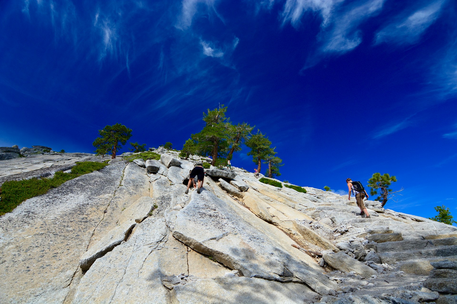
If the cables are too much (or you can’t get a permit) you can still climb as far as Sub Dome, which is where the cable section starts. The views from here are still really impressive, and the hike is intense.
Planning tip: You can only summit Half Dome between Memorial Day and Columbus Day, and you’ll need a permit to hike past the Sub Dome area. Apply online in March for one of the 225 hiking permits offered each day of the season. The NPS issues them via a lottery system, and competition is stiff.
 El Capitan can be seen from numerous points around the park © bluejayphoto / iStockphoto / Getty Images
2. Experience the magic of El Capitan
Yosemite’s other legendary slab of rock is El Capitan, which garnered a lot of attention after Alex Hannold’s free solo climb in June 2017. The subsequent Academy Award–winning Free Solo documentary told the story of Hannold becoming the first person to summit El Capitan using only his hands, no ropes.
Today, this nearly 3600ft sheer cliff remains a mecca for climbers. On Yosemite Valley’s north side, it can be seen from numerous points of interest around the park. These include the Tunnel View lookout and El Capitan Meadow. The latter is the best spot to photograph this massive rock (it is 1000ft taller than Half Dome’s face). You’ll find the meadow on the North Drive through the Yosemite Valley.
Detour: While this trail is not officially sanctioned by the park, it is used daily by flocks of rock climbers. If you want to watch them or just to lay your hand on the rock wall, head to the trailhead on the right side of North Drive, just beyond El Capitan picnic area. You’ll find trail markers pointing toward El Capitan as far as an open field. From here you can scramble up small boulders to the base of the rock wall.
3. See the Yosemite Valley from Tunnel View Lookout
The Yosemite Valley is where many of the park’s top attractions are located, including Tunnel View lookout. The parking lot is located right off Hwy 41, just east of Wawona Tunnel as you enter the Yosemite Valley, and it offers spectacular views of the Yosemite Valley. You’ll be able to see El Capitan to your left, Bridalveil Falls to your right and Half Dome in the distance. In the foreground is a sea of green trees and more granite cliffs.
Try to visit just before or at sunset, when the granite monoliths glow golden from the setting sun and the green of the trees is especially vibrant. Crowds can be serious, however, in summer. If you are visiting in winter, you might have the place nearly to yourself. The granite walls look especially magical when blanketed in snow. Come in May to see Bridalveil falls at peak flow.
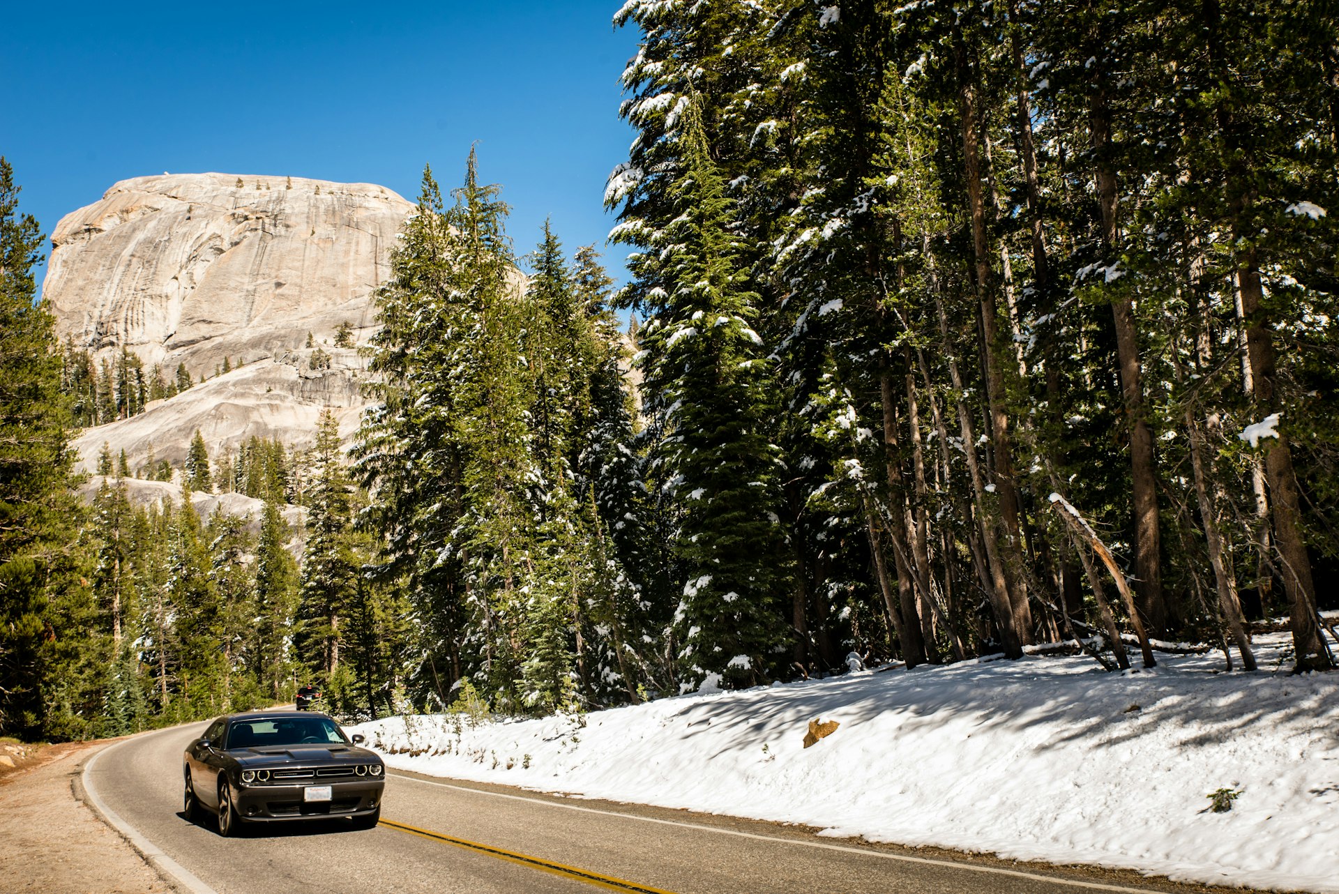 Driving Tioga Road is worth the price of admission alone © Dietwal / Shutterstock
4. Drive Tioga Road
Running east-west across Yosemite, Tioga Rd is only open in the summer. Opening and closing dates vary based on when the road can be cleared in spring and when it first begins to snow in fall. Beginning at Tioga Pass, at the park’s east entrance, with an elevation just shy of 9945ft, Hwy 120 is a wonderfully scenic 46-mile drive, and traversing it to Crane Flat in the west is well worth the park fee alone.
The drive takes you past Tuolumne Meadows, wide-open subalpine terrain bisected by the curvaceous Tuolumne River. You’ll also pass wildflower-strewn fields, deep-green forests, granite domes and hiking trails that lead to clear-blue mountain lakes, into which craggy granite peaks are reflected in the right light.
5. Photograph Yosemite Falls in spring
One of Yosemite’s most memorable sites is Yosemite Falls, and what makes it so alluring is that it only exists for part of the year. Spring is the best time to see the falls – it’s at its mightiest and most photogenic between April and June, thanks to melting snow. By August, however, the waterfall is usually down to a trickle or completely dry. Late fall storms can bring more water to Yosemite Falls, and in winter you may see an ice cone at the base of the upper falls.
One of the tallest waterfalls in the world, Yosemite Falls is made up of three waterfalls. Upper Yosemite Fall drops 1430ft down a granite wall, then the middle cascades drop 675ft before Lower Yosemite Fall drops off another ledge for 350ft.
Planning tip: There are lots of spots to photograph Yosemite Falls in spring. If you want to walk, you can take a 1-mile loop trail to the base of Lower Yosemite Falls. This is also the start of the Yosemite Falls hike, which is a strenuous, day hike of close to 8 miles. But walking to the base of the falls is easy and still gives a great perspective.
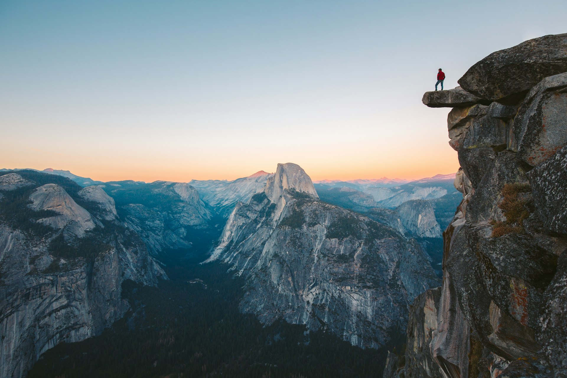 Glacier Point has one of the most impressive views in the park © canadastock / Shutterstock
6. Stroll to Glacier Point lookout
Open only from late May through October, Glacier Point Rd is one of the park’s most famous drives. It takes you to Glacier Point, one of the most impressive views in the entire park, looking out over Yosemite Valley, Half Dome, Yosemite Falls and the park’s high country.
The lookout itself, which is 3214ft above Curry Village, is accessed from the Glacier Point parking lot via a short, wheelchair-accessible paved trail. During the months when the road is open, you can also visit the lookout on the Glacier Point bus tour.
Detour: After checking out the viewpoint, take the Four Mile Trail down to Yosemite Valley, some 3200ft below. A little less than 5 miles long (the name is confusing), the trail is steep with some good views and drops you out near Sentinel Rock. You can also hike it up to Glacier Point. Either way, check the bus schedule to see if you can catch a ride back the other direction.
7. Hike to Columbia Rock and beyond
Yosemite National Park is a hiker’s paradise, with more than 750 miles of trails to explore. One of the top moderate hikes in the park is up to Columbia Rock, from which you have 180-degree views of Yosemite Valley, including Half Dome to the east and Cathedral Spires to the west.
The 3-mile roundtrip hike begins at the Lower Yosemite Falls trailhead and gains about 1000ft in elevation as it continues onto the Upper Yosemite Falls trail, making it a relatively demanding hike complete with switchbacks. The trip takes between two and three hours, depending on how fast you walk.
Columbia Rock is also part of the trail system that initially takes you to the top of Yosemite Falls, located another two-thirds of the way on the Upper Yosemite Falls trail. You won’t be able to see the falls from the lookout, but continue for another half-mile and you’ll get great views of them. You can also continue to the top, which is a 7.6-mile round trip.
8. Bike to Mirror Lake
If you are looking for an easy, family-friendly bike ride that also offers awesome, just-in-front-of-you views of Half Dome, consider the Mirror Lake trail. The paved service road runs along the north side of the river and is part of Yosemite National Park’s 12 miles of paved bike paths.
Bike rentals are available at Curry Village. From here it is an easy .8-mile ride via Happy Isle Loop Rd to the Mirror Lake Trailhead. The path can also be walked, so keep an eye out for pedestrians. Note that to reach the upper section of the lake itself, which is known for its Half Dome reflections, you’ll need to walk the final, short portion of the trail.