Honduras may be known by some tourists for its collection of fine beaches, but this Central American nation has its share of great hiking trails ideal for the more active traveler.
There’s a diversity of landscapes in all of Honduras’ best places to visit – from the Bay islands in the Caribbean Sea to the rainforests and cloud forests of its national parks – so there are plenty of different trail terrain all across the country. Some trails are even accessible from urban centers, allowing walkers to escape city life and enjoy a bit of fresh air.
Discover the world’s most intriguing experiences with our weekly newsletter delivered straight to your inbox.
As far as safety is concerned, you’ll be fine as long as you keep your wits about you, just like anywhere in the world. However, it’s recommended to hike only during daylight hours – so be mindful of when sunset is – or to go with a guide in most cases to avoid getting lost. Fortunately, there are plenty of services out there, and guides are typically available at many of the national park entrances.
So wherever you are in the country, you’ll be near a trail, be it for a quick, casual hike, or a multi-day excursion.
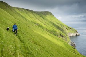
 See the waterfalls of Pico Bonito National Park on one of the many hiking trails © Manuel Chinchilla / Getty Images
1. El Mapache Trail, Pico Bonito National Park
Best hike near the Rio Cangrejal
7.2km (4.5 miles) round trip, 4 hours, moderately challenging
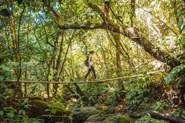
Pico Bonito National Park, encompassing 565 sq km (350 sq miles) of tropical rainforest near the city of La Ceiba, is the country’s showcase biosphere with the largest collection of flora and fauna. At the center is the namesake “Beautiful Peak” surrounded by mountainside terrain adorned with many waterfalls. Not surprisingly, there are hiking trails that lead you to some of them.
If you’re based in El Naranjo, the adventure hub of activities in and around the Rio Cangrejal, the best hike is along the 7.2km (4.5miles) El Mapache Trail. Considered moderately challenging, the trail starts at the hanging bridge over the Cangrejal and ascends to the showcase cascade in the El Bejuco section of the park.
While you could navigate the trail yourself, it’s definitely recommended to go up and down with a guide. In fact, with local guiding companies like Omega Tours or La Moskitia Ecoaventuras, you can turn the typical 4-hour round-trip excursion into an overnighter with some added trail time and camping gear provided. You can organize this with the outfitters directly, or if you’re staying at La Villa Soledad across the street from the trailhead, just ask at reception.
2. Unbelievable Falls Trail, Pico Bonito National Park
Best hike in Pico Bonito National Park
5.5km (3.4 miles) round trip, 2 hours, moderately challenging
In another area of the sizable Pico Bonito National Park, jetsetters may be drawn to the luxury amenities of The Lodge at Pico Bonito National Park. However, at its heart is the natural beauty of the park itself, and you don’t necessarily need to stay at the lodge to access the trails that begin there.
Going deeper into the rainforest, the most worthy, and thus most popular trail is the one that leads to the aptly-named Unbelievable Falls. This moderately-challenging 5.5km (3.4miles) trail takes about two hours to complete – going to the falls and back to the lodge – unless you find yourself preoccupied with all the birdwatching opportunities, or swimming at the natural pools at the base of the falls (don’t forget your swimming gear).
 Get panoramic views of Guanaja on a hike to the top of Michael’s Rock © EmLion / Shutterstock
3. Michael’s Rock Peak Trail, Guanaja
Best hike in the Bay Islands
4km (2.5 miles) round trip, 2 hours, moderately challenging
Anyone who’s visited all three Bay Islands will likely tell you that the most pleasing of them is Guanaja. Unlike Roatán or Utila, Guanaja hasn’t been overtaken by mass tourism (yet), and represents the island scene before the dawn of resort construction: lush, pristine green hills – some primed with trails for you to grace your hiking boots on.
At the center of Guanaja is the island’s highest point, the peak of Michael’s Rock (412m/1351ft), and a few trails make the ascension that gives you a panoramic view of the island and beyond. The most popular trek starts at Hammond Beach on the north coast, which goes up to the summit and back down the way you came. It takes about two hours for this 4km (2.5 miles) option, which you can rightfully conclude with a well-earned cocktail at a beach bar.
However, if you’re feeling ambitious, you can continue to hike southbound from the peak to Sandy Bay, traversing the entire span of the island – 11.8km (7.3 miles) in total. Another way to descend from the peak is to have a guide lead you down the northbound trail towards the waterfall – it’s the only one across the Bay Islands, after all. Beware though, the trail ends in an area so secluded that you’ll have to arrange with a local boat captain to pick you up.
4. The Coca-Cola Trail, Cerro Merendón, San Pedro Sula
Best hike from San Pedro Sula
6.9km (4.3 miles) round trip, 3 hours, moderately challenging
If you find yourself in San Pedro Sula – which is often inevitable since it’s the country’s main commercial and transportation hub – there are plenty of city experiences to enjoy from restaurants to nightlife. However, one getaway from the urban sprawl is a hike up to the peak of the adjacent metropolitan mountain, Cerro Merendón, along the “Coca-Cola Trail.” It’s named after the popular soft drink because the trail leads to the big “Coca-Cola” sign that overlooks the city.
As one of the most popular and straightforward hikes in the area, you won’t be alone, so there’s no need for a guide here. You and your fellow hikers will be rewarded with views of San Pedro Sula as you ascend up the mountain along the 6.9km (4.3 miles) in-and-out trail to Merendón’s peak. The Coke sign is about two-thirds of the way up this moderately-challenging trek, and you won’t be alone if you decide to stop the upward climb there and make your way back down for a shorter hike.
5. Angeli Gardens, San Pedro Sula
Most relaxed hike
2km (1.25 miles) round trip, 1 hour, easy
For a much more casual hike in San Pedro Sula – complete with food and a craft beer at the end – head to Angeli Gardens in the El Merendón area of the city. Once a plant nursery, Angeli Gardens evolved into the city dwellers’ favorite oasis with a restaurant, craft brewery, music venue, and event space, plus its own botanical garden with private hiking trails through the area where the city meets the Merendón mountain range.
The easy trails are only about 2km (1.25 miles), so it’s not much of a time commitment, although you can extend your time there with a zip-line canopy option. While not in a national park, the grounds are manicured for an optimal escape from the city, with a hammock bridge and sweeping views of the city at some vantage points. Also, you might still spot wildlife, including armadillos, toucans and other birds.
After hiking, there’s an inevitable, yet welcoming stop at Angeli Gardens’ restaurant and craft brewery, Cerveceria Del Bosque, where you can finish off your excursion with a flight of brews, or even a Saturday evening music set if you sync your visit with the event schedule in mind. Either way, admission to the private trails costs just L125.
 Hire a guide to help you get the best out of a trek through the old mining region of La Tigre © Carlos Torres / Shutterstock
6. The Mine Trail, Parque Nacional La Tigra
Best hike near the capital city of Tegucigalpa
7.5km (4.7 miles) round trip, 4 hours, moderately challenging
Honduras’ capital city Tegucigalpa is another urban center worth exploring, but a popular day trip away from city life is at the country’s first national park, La Tigra, about an hour’s drive north (admission: L250). There are several hiking trails in this cloud forest nature preserve, but the most notable is the Sendero La Mina, a 7.5km (4.7 miles) in-and-out trail up a mountain to a waterfall. Note that there’s a lot more water flowing than just at the cascade, so make sure you pack rain gear, good boots and warm layers.
Transformed from a former mining route, you’ll see remnants of Honduras’ mining past along the way: entrances of abandoned mines, old mining company buildings, and the iron door built into the side of the mountain where dynamite was once stored. While you could explore them on your own, going with a company like La Tigra Tours is recommended. The guide can best show you how to navigate the ins and outs of the trail with all its caverns, dripping with water.
7. The Sinaí Trail, Cerro Azul Meambar National Park
Best hike for birdwatching
6.8km (4.2 miles) loop, 3–4 hours, moderately challenging
Birdwatchers know to flock to the Lake Yojoa region in the western interior of the country because Honduras’ largest lake is a haven for many local and migratory birds. Flanking the lake to the east and west are two lush national parks, but it’s Parque Nacional Cerro Azul Meambar in the east, known by the acronym PaNaCAM, that has hiking trails accessible from the Panacam Lodge – hiking and birdwatching guides are readily available at the visitors center.
There are three main trails here, but arguably the country’s best hiking trail for birdwatching – particularly in the early morning – is the challenging Sendero Sinaí, a 6.8km (4.2 miles) loop that undulates up and down the cloud forest terrain. Along the way, there are a couple of waterfalls, plus a few platform miradors with unobstructed views above the canopy to better spot birds flying to and from the lake, or perched on a distant branch. Be sure to also keep an eye out for other animals, like frogs or pisotes (raccoon-like coatimundis), that you may encounter along the way.
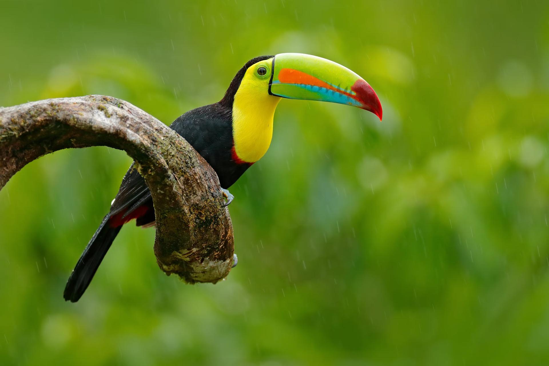 Look out for colorful birdlife on your treks through Honduras © Ondrej Prosicky / Shutterstock
8. Quetzal Waterfall Trail, Parque Nacional Cusuco
Best easy hike in the remote wilderness
4km (2.5 miles) round trip, 1 hour, easy
In the less frequented northwest corner of the country, near the border with Guatemala, is Parque Nacional Cusuco, home of some of Central America’s most pristine, yet accessible land. In fact, a few research expedition camps are stationed there at certain times of the year for those studying ecology and biology. The remote location in the Merendón mountain range affords an abundance of wildlife: toucans, frogs, and howler monkeys to name a few. Its lush, pristine cloud forest terrain is also home to a few waterfalls, each with a trail connecting it from the village of Buenos Aires within the park.
Hiking trails that lead to the Toucan Waterfall or Orion Waterfall take about 90 minutes on a round trip, but if you want an easy one, hike for about an hour along the Quetzal Waterfall Trail (4km/2.5miles), named after the teal-feathered bird that was considered sacred by the Mayans. You may actually see one on your way, with better chances in the spring and early summer.
If you can get to Cusuco National Park on your own, hire a guide at the visitors center. However, there’s no easy public way to get there, so it’s recommended to go with a local tour operator, like Cusuco Tours in San Pedro Sula, 2.5 hours away (L2500 including transportation). It can also organize other experiences in the park, including a hike to the Dwarf Forest, or a visit to the nearby coffee plantation.
9. Cerro Las Minas, Parque Nacional Montaña de Celaque
Highest hike in Honduras
20km (12.5miles) round trip, 2 days, challenging
If you’re looking for a challenging two-day adventure, head to Parque Nacional Montaña de Celaque near the town of Gracias, for a trek up to the highest peak in the country, Cerro Las Minas (2870m/9416ft). It’s rugged and wet terrain out there, so definitely go with a tour operator like Senderismo Tours, Señor de las Montañas Tours, or Celaque Tours, each charging about L2500 for a gear-supported two-day excursion including food.
The first day involves an increasingly steep trek through the vegetation of the cloudforest as you begin the 1890m (6200ft) elevation gain up the mountain. Mist and fog will get thicker as you ascend into the clouds. By afternoon, you’ll arrive at an established encampment, where you’ll crash for the night in tents or cabins, depending on availability.
The following day begins in the wee hours of the morning so that you can arrive at the top for sunrise. On a clear day, the spectacular view you’ll have from the roof of Honduras will reveal the other peaks of this mountainous region and even a glimpse of the ocean. Afterward, it’s all downhill from there, going back the way you came. When it’s all over, you can relish the fact that you’ve just hiked a rugged 20km (12.5 miles).