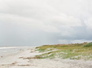
If you love uniquely incredible landscapes and thrilling outdoor adventures, a road trip through the Southwest should be at the top of your list. The Petrified Forest, Saguaro, White Sands, Mesa Verde, Joshua Tree and more are just some of the National Parks in this beautiful region of the US, connected by miles of road and open sky.
In this particular itinerary we’ll start in Arizona, tracing the Colorado River to find a string of desert jewels, from the Grand Canyon to Arches and beyond. Then we’ll turn those canyons inside out as we climb the Rocky Mountains, with their dizzying chasms and folded rock formations.
Crumbly hoodoos, graceful spans, glowing buttes and crimson ridges – is your camera battery fully charged?
 The Sonoran Desert is great for stargazing, wildlife watching, and nature photography © PICTOR PICTURES / Shutterstock
Begin your road trip in Phoenix
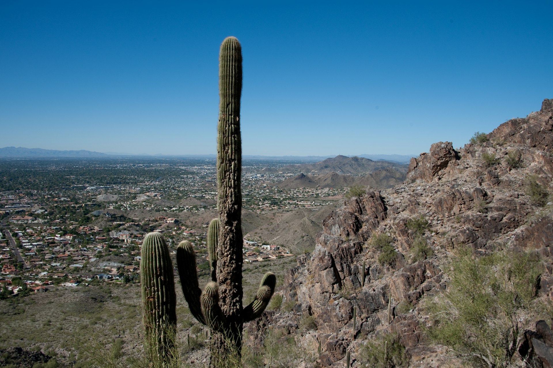
With more than 300 days of sunshine each year, Phoenix is amazing for outdoor enthusiasts and the perfect jumping-off point for a nature-based road trip. Nicknamed “the Valley of the Sun” due to its place within the surrounding mountains, it’s ideal for hiking. The Phoenix Mountain Preserve offers more than 40 miles of trails, from easy walks to challenging treks, most with incredible views of the city.
When you’re ready to cool off, the city has several nearby lakes for boating, fishing and water sports, including Lake Pleasant, Saguaro and Canyon Lakes. The area is also a major attraction for golfers, with world-class golf courses including TPC Scottsdale – home to the largest PGA tournament in the world.
Not thrilling enough for you? Go rock climbing, horseback riding or up in a hot air balloon. The nearby Sonoran Desert is also great for stargazing, wildlife watching, and nature photography.
The drive: Head to one of the most famous National Parks of all, the Grand Canyon. Take I-17 North to Flagstaff (144 miles, about 2.5 hours), or I-40 West to Williams and head north on AZ-64 to Tusayan (81 miles, about another hour and a half).
 The Grand Canyon’s unique geological story spans more than 2 billion years of Earth history © Galyna Andrushko / Shutterstock
Grand Canyon National Park
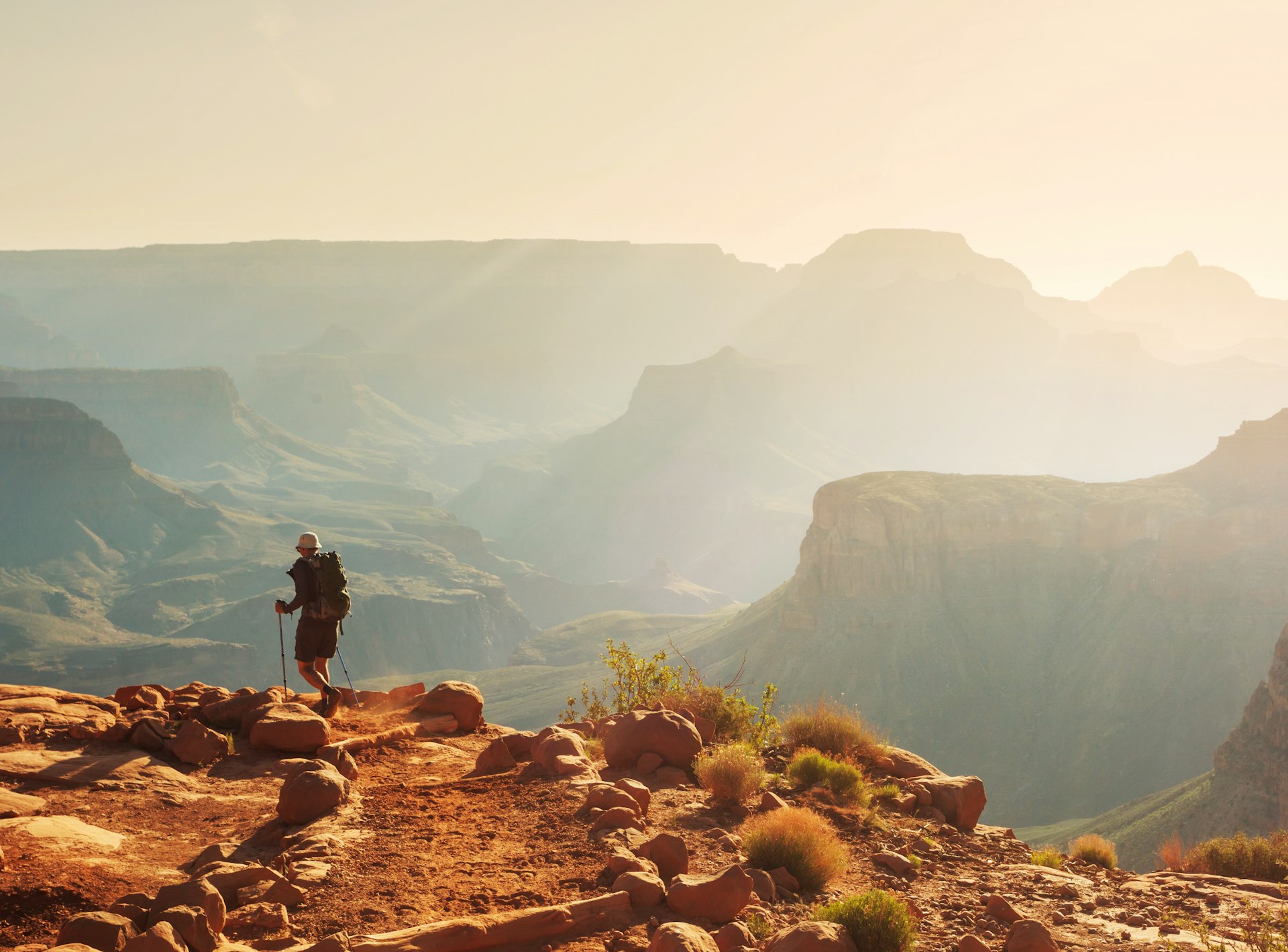
The Grand Canyon is truly a spectacular sight and one of the most awe-inspiring natural wonders in the world. What makes this park so special is its vast size, stunning beauty, and rich geologic history. At 277 miles long, 10 miles wide, and more than a mile deep in places, it’s one of the largest canyons in the world – so large, in fact, it has five different ecosystems.
The park’s unique geological story spans more than 2 billion years of Earth history, with layered rock formations clearly marking the geological eras. The Grand Canyon also is home to a diverse array of plant and animals, including rare and endangered species, making it a haven for nature lovers.
Before you leave the park, be sure to stop by the Desert View Watchtower at the east entrance for what many consider to be the best viewpoint of the Canyon. But whether you’re simply enjoying the views from an overlook, taking a scenic drive, or hiking all the way to the bottom, the Grand Canyon will leave you in awe of its stunning beauty and natural wonder.
The drive: Make your way toward the outdoor adventure center of Page, Ariz. – Head east on 64 and then north on 89. At the fork for 89a you’ll turn right to head to Page, but if you have the time, a side trip the other way is worth the extra miles. The towering Vermilion Cliffs are highlights of the journey as you detour to Marble Canyon and a walk across stunning Navajo Bridge, then to Lees Ferry, the put-in point for rafting trips down the Colorado River. Turn around at this point and make your way back to 89, and Page.
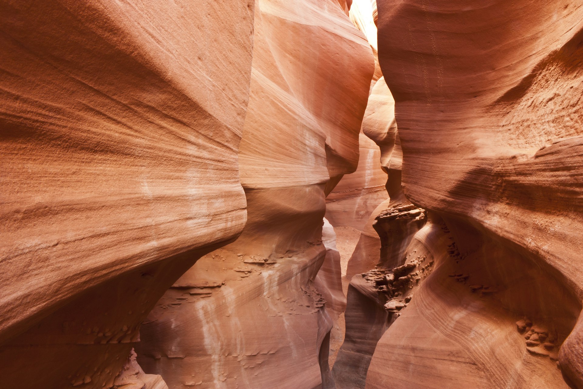
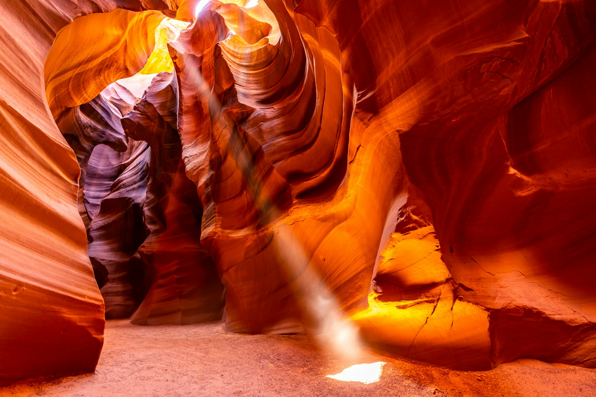 Antelope Canyon is one of the most photographed locations in the world © vichie81 / Shutterstock
Page, Ariz. / Navajo Nation
Page is a picturesque town, and a hub for adventures amid some of the most spectacular natural wonders in the Southwest. The area is famous for Antelope Canyon, a stunning slot canyon that is one of the most photographed locations in the world. The canyon walls, formed by thousands of years of wind and water erosion, are an otherworldly landscape of curving lines, twisting shapes, and vibrant colors.
Other nearby natural wonders include Lake Powell, a man-made reservoir with more than 2,000 miles of coastline, offering unparalleled boating, fishing, and water sports. The lake is one of the most scenic in the country, nestled within red rock cliffs and canyons. As a result of drought, the lake is down significantly. However, the once-flooded Glen Canyon is now revealing its secrets – the return of hanging gardens, Native American footholds carved in the rocks, animals, grottos, and gigantic caves.
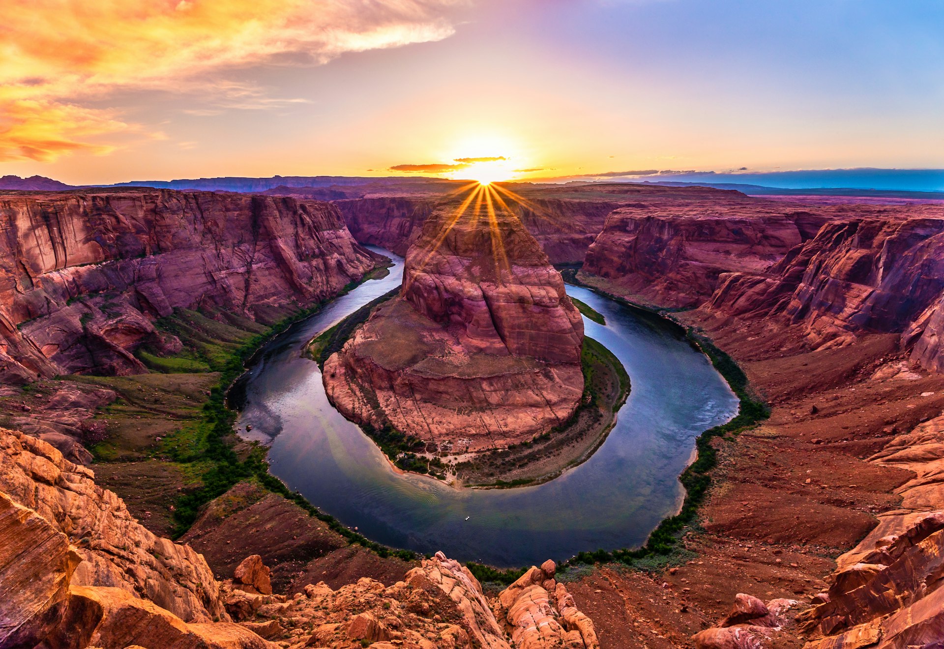 Horseshoe Bend offers a slew of hiking and off-road trails to explore, either on mountain bike or via an off-road vehicle © Shawn Mitchell Photo / Shutterstock
Also close is Horseshoe Bend, a unique phenomenon where the Colorado River bends in the shape of a horseshoe for amazing views.
The region offers a slew of hiking and off-road trails to explore, either on mountain bike or via an off-road vehicle, both of which are available for rent in town.
The drive: From Page, make your way North to Utah on Hwy 89, and then east on Scenic Hwy 12. Highlights of the 150-mile (2.5 hours) journey include Amangiri Resort, a luxurious and exclusive celebrity magnet, and the Toadstool Hoodoos, a unique rock formation with mushroom-like shapes and red and white stripes. Just past the Toadstool trailhead, look for Buckskin Gulch – this slot canyon, accessible via the Wire Pass Trail, is an amazing sight. Finally, stretch your legs with a short hike through breathtaking Red Canyon.
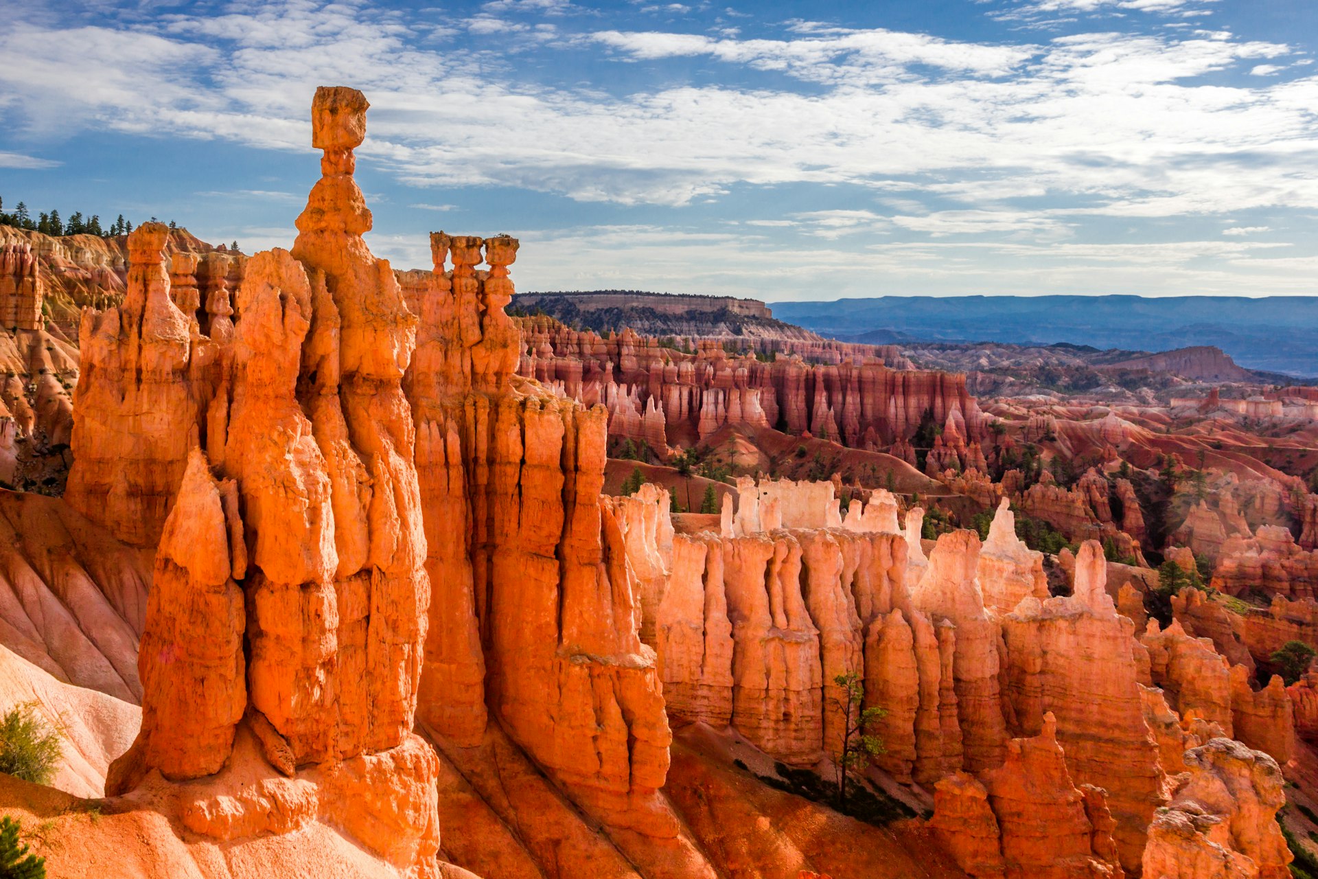 Sandcastle-like pinnacles known as hoodoos, jutted fins, and huge amphitheaters filled with thousands of pastel daggers mark Bryce Canyon National Park © iacomino FRiMAGES / Shutterstock
Bryce Canyon National Park
The high altitude of Bryce Canyon National Park sets it apart from southern Utah’s other parks. Repeated freezes and thaws have eroded the small park’s soft sandstone and limestone into a landscape that’s utterly unique: sandcastle-like pinnacles known as hoodoos, jutted fins, and huge amphitheaters filled with thousands of pastel daggers.
Visitors can hike among these natural wonders and enjoy dramatic views from several overlooks. With its incredible geology, Bryce Canyon is one of the most visually stunning national parks in the country. The park is relatively small, so even if you don’t have much time you can explore in just a few hours.
 The rock walls form a wave texture in Peek-a-Boo Slot Canyon in Escalante National Monument © Colin D. Young / Shutterstock
After visiting the park, take a scenic journey along Route 12, which passes through the magnificent Escalante area, and has several other places worth visiting along the way. Check out Peek-a-Boo, a narrow and twisting slot canyon for a challenging but rewarding hike. For excellent off-roading, head to Swing Arm and Factory Butte – Swing Arm is a popular spot for off-road and motorcycle enthusiasts while Factory Butte is a landmark mesa rising over 1,000 feet above the valley.
When you’ve wiped yourself out, Nearby Calf Creek Campground is a great spot to set up camp, whether you have a tent or a small RV. The sound of the creek is soothing and will help you relax after a full day of outdoor activities.
The drive: One of the best things about Southern Utah is the proximity of so many excellent National Parks. It’s only about 100 miles (2 hours) from Bryce Canyon National Park to Capitol Reef National Park via Johns Valley Rd, UT-62 E and UT-24 E.
 The Waterpocket Fold, a nearly one hundred mile feature in the earths crust, constitutes Capitol Reef National Park © Kenneth Keifer / Shutterstock
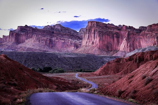
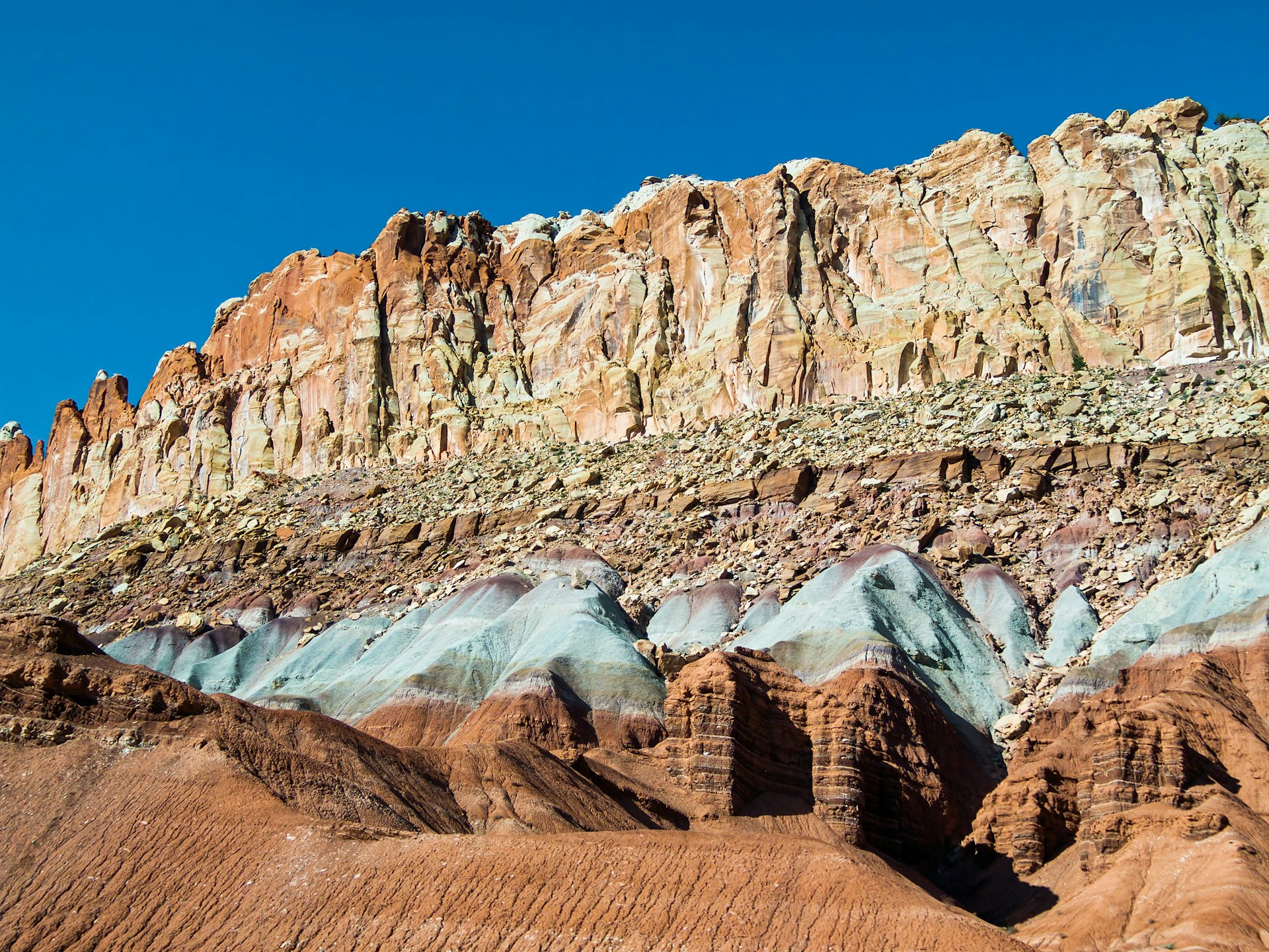
Capitol Reef National Park
Known for its enormous domes – one of which echoes Washington, DC’s Capitol Dome – Capitol Reef National Park harbors fantastic hiking trails, rugged 4WD roads and 1000-year-old petroglyph panels. The area’s colossal cliffs, narrow canyons, and vivid red rock formations echo with the soothing sounds of the Fremont River.
The highlight of the park is Waterpocket Fold, a 100-mile-long wrinkle in the earth’s surface – a remarkable phenomenon. The park is also home to the historic Pioneer Register, a collection of pioneer signatures and inscriptions dating back to the late 1800s, and the Fruita Rural Historic District, which offers a glimpse into the area’s farming history and importance to the Mormon settlement.
Technical rock climbing is allowed in the park without permits, and many of the moderate-to-difficult trails will lead to excellent climbing opportunities and views. But whether you’re climbing the sandstone, hiking through the narrow canyons, taking a scenic drive, or exploring the park’s cultural history, Capitol Reef is a wonderful experience.
The drive: Stop in Hanksville to fuel up. Just north, there is a notable rock formation called Kathleen Rock, which is an excellent place to boondock, explore or climb to the top. From there, head east on 24 for 50 miles until you reach Temple Mt. Road and toward Goblin Valley State Park.
 Goblin Valley State Park’s ‘goblin’ rock formations are made from eroded sandstone and resemble whimsical creatures © IrinaK / Shutterstock
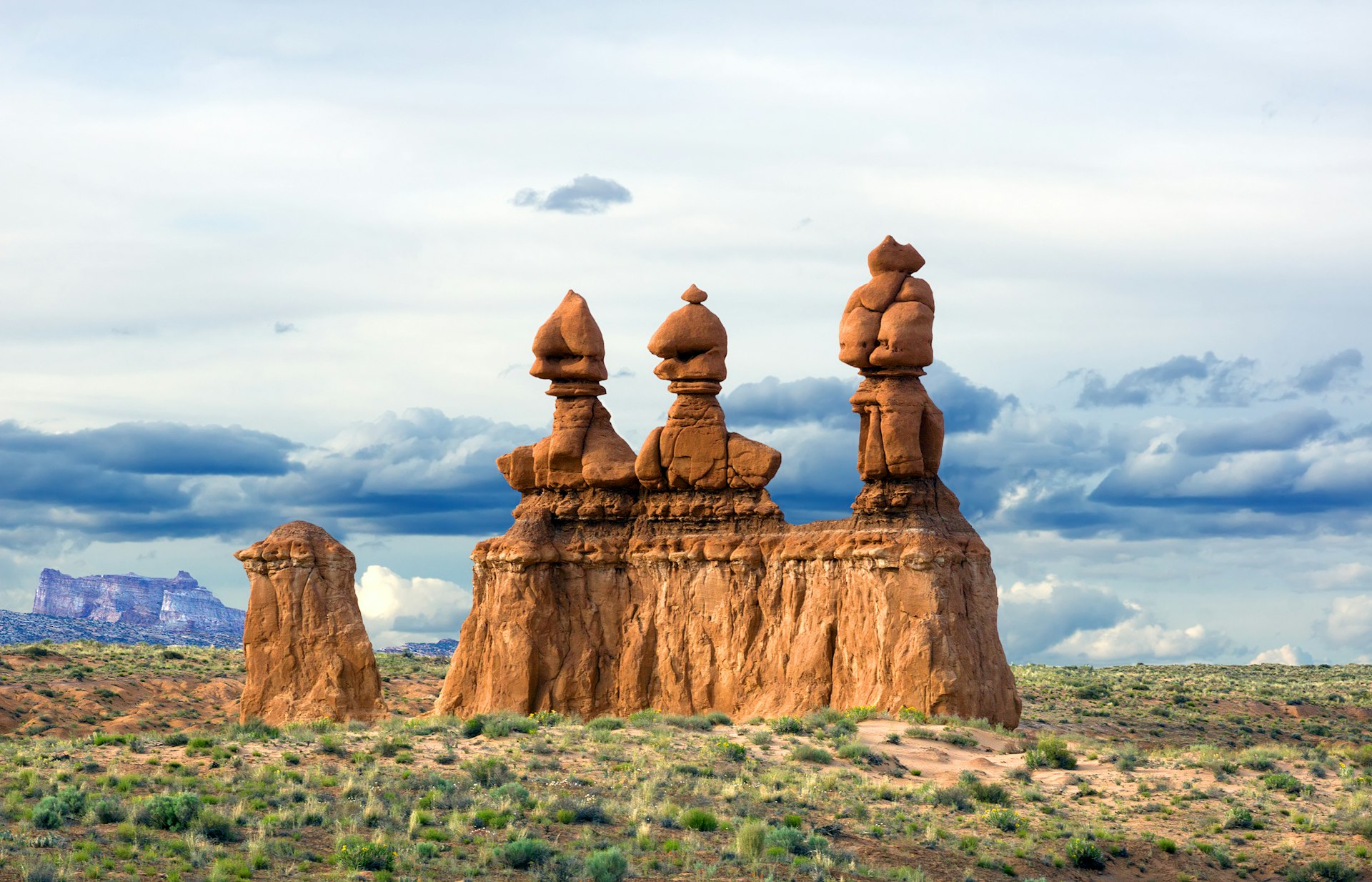
Goblin Valley State Park, Arches National Park and Moab
Goblin Valley State Park is an unearthly place known for its unusual rock formations called goblins, which are formed from eroded sandstone and resemble whimsical creatures. The park offers miles of trails and backcountry roads, allowing visitors to explore the valley with endless places to boondock camp. The goblin-filled landscape is truly one of a kind and offers visitors a chance to step back in time and imagine what the world might have looked like millions of years ago.
After visiting the park, it’s worth continuing the adventure by driving west on Wild Horse Road outside of the park. There are many free dispersed camping spots available to enjoy a night under the stars. From there, it’s another hour and a half north on 24, east on I-70 and then south on 191 toward Moab. This is southern Utah’s adventure base camp – doling out hot tubs and pub grub after days spent hiking, biking and 4WD-ing.
 Arches National Park is a one-of-a-kind destination that showcases the power of nature over the landscape through the eons © Andrew Repp / Shutterstock
Nearby Arches National Park is a one-of-a-kind destination that showcases the power of nature over the landscape through the eons. The park is home to more than 2,000 natural sandstone arches, spires, balanced rocks, and other unique rock phenomenon. These geological wonders were formed over millions of years through a combination of erosion and geological uplift.
The park has many short hikes, plus excellent rock climbing. Arches is also geared well to drivers, with most of the main sights within a mile or two of paved roads. A 45-mile loop is packed with photo ops.
On your way out of Arches, take Hwy 128 – It’s known for its incredible views of the Colorado River and the red rock formations that line the road. The route follows the river as it winds its way through the canyon and passes by iconic landmarks such as Fisher Towers, Castle Valley, and the Moab Rim. The area along byway 128 has been featured in several movies and TV shows over the years, including Mission: Impossible 2, 127 Hours, The Lone Ranger, Planet Earth, and even several scenes of Breaking Bad.
The drive: After taking 128 North, turn on I-70 east, going across the Colorado border to Grand Junction. From there, merge onto 50 toward Black Canyon of the Gunnison National Park. The whole leg is 165 miles, or two and a half hours.
 No other canyon in America combines the narrow openings, sheer walls and dizzying depths of the Black Canyon © corlaffra / Shutterstock
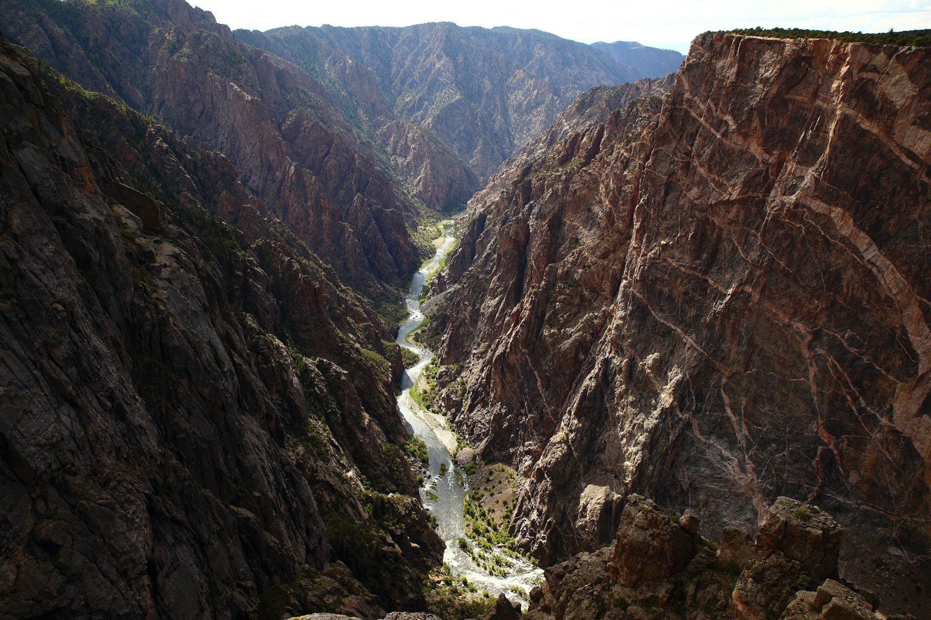
Black Canyon of the Gunnison, and the Colorado Rockies
Black Canyon is home to a deep and narrow canyon that offers striking views of sheer cliffs and mighty rock formations. No other canyon in America combines the narrow openings, sheer walls and dizzying depths of the Black Canyon, and a peek over the edge evokes a sense of awe (or vertigo).
Visitors can explore the park via a scenic drive, hike one of its many trails, or take a ranger-led tour to learn more about the park’s unique geology and history. The park also offers excellent opportunities for rock climbing, fishing, and wildlife viewing, making it a popular destination for outdoor enthusiasts.
 A road trip is the perfect way to see one of the most beautiful mountain ranges on Earth – the Rockies © Paul Brady Photography / Shutterstock
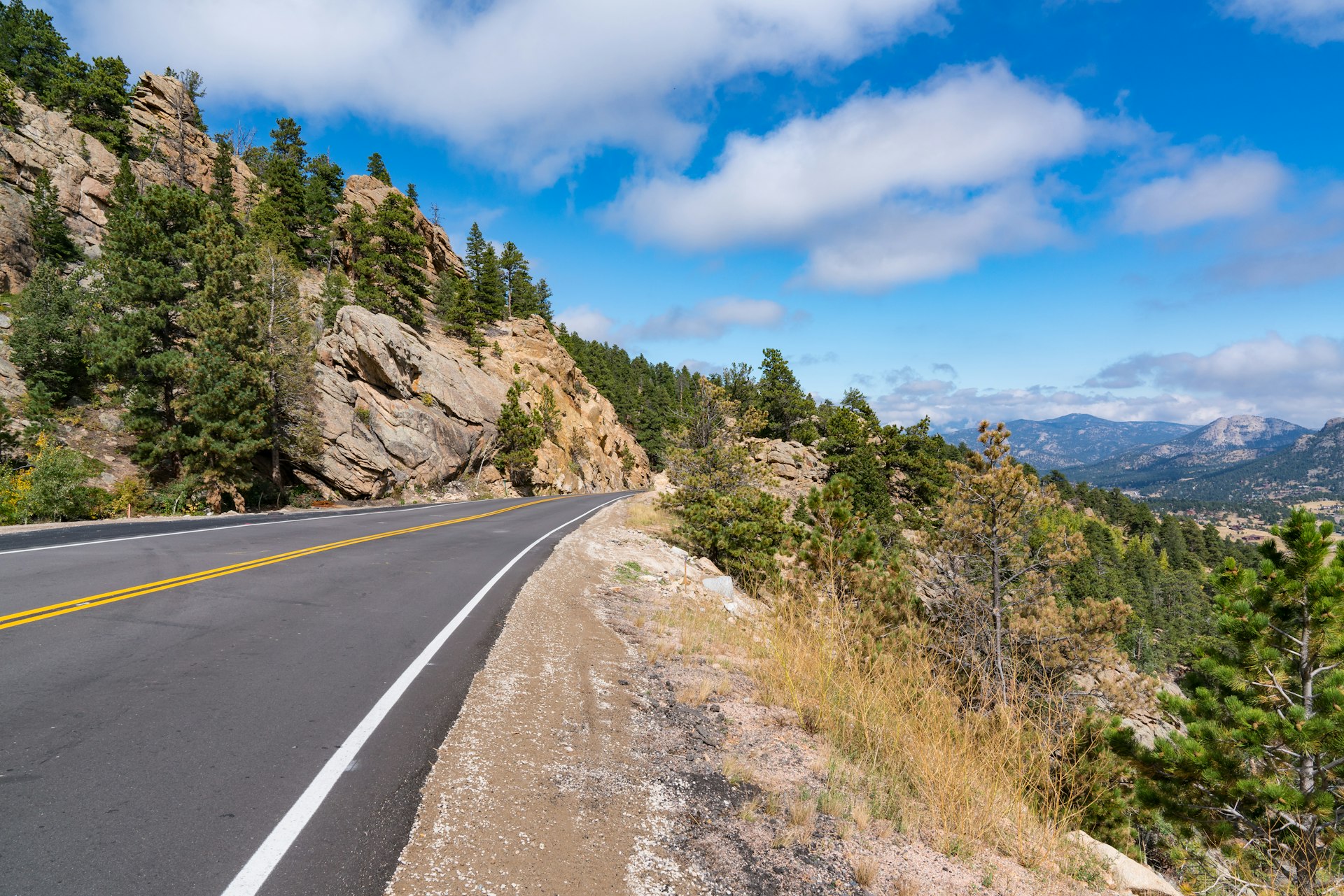
Up to now we’ve been exploring the valleys and canyons of the American Southwest. Now it’s time to turn those chasms inside out, climbing through the heart of the Rockies. The next leg is one of the longest, but you’ll never be starved for scenery. Take CO-133 N to Glenwood Springs and get on I-70 East to Nederland, about 5 hours. From there it’s less than an hour to the amazing mountain town of Estes Park, the gateway to Rocky Mountain National Park.
A road trip is the perfect way to see one of the most beautiful mountain ranges on Earth. Combine America’s love of cars with the majesty of the Rockies’ imposing purple mountains and you get a road-tripper’s playlist second to none. You’ll lose count of how often you look up and have the beauty of what you see bid you silent.
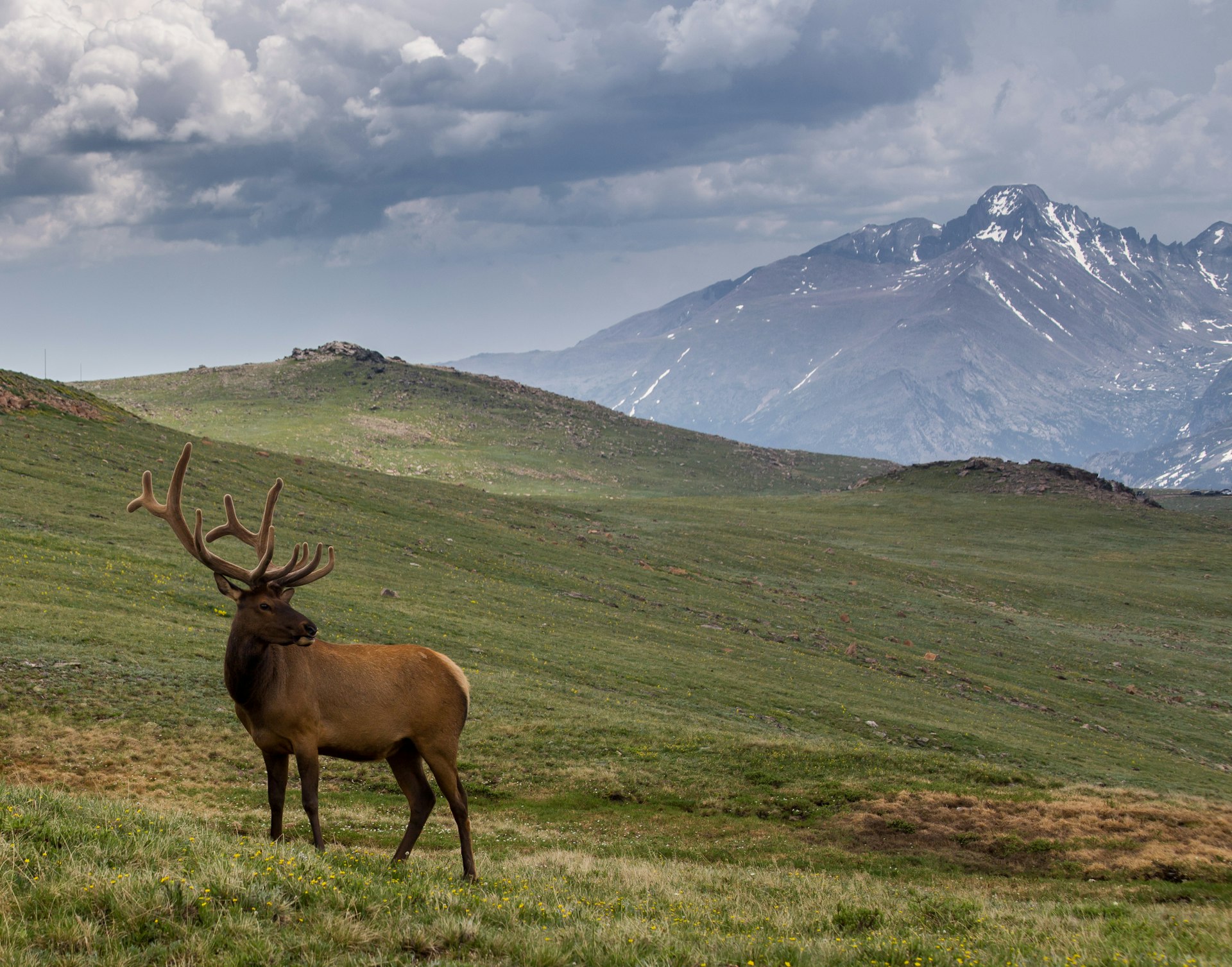 Bull Elk on Trail Ridge Road in Rocky Mountain National Park © Bridget Calip / Shutterstock
Extend your trip
If you have a few more days, Rocky Mountain National Park will certainly fill that time with adventures aplenty. Watch the Elk graze beneath the bald mountains. Go backcountry hiking, leaving the crowds behind as you move through this massive and majestic wilderness, passing sparkling alpine lakes. When those lakes are frozen over, go snowshoeing, split boarding, or backcountry skiing. Learn to climb on the granite cliffs of Lumpy Ridge and reach the summit of Longs Peak. Or, if driving is more your speed, trail Ridge Road is one of America’s most bejeweled scenic routes.