
Think of Buenos Aires, and lanes of traffic passing the Obelisco on Avenida 9 de Julio might spring to mind.
The city’s emblematic broad avenues form part of a grid layout that makes navigation simple, and although traffic can be slow-moving, getting around is easy thanks to Buenos Aires’ public transport system.
Get local insight on destinations all over the world with our weekly newsletter delivered to your inbox.
The best way to explore the city’s neighborhoods is often on foot. For longer journeys, hop on a bus or bicycle or take the subway. Using public transit in Buenos Aires is generally safe, but as in most large cities, it’s best to watch your wallet and keep your phone out of sight.
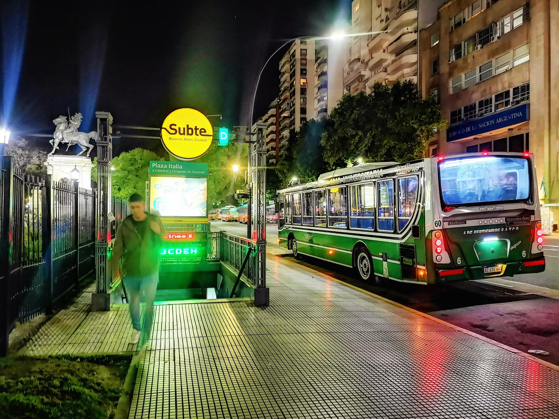 Buenos Aires is home to the first subway system in Latin America © Nicolas McComber / Getty Images
The subway is the quickest way around the city
Buenos Aires’ Subte network is the oldest in South America. The first line was inaugurated in 1913. It’s often the quickest way to move around the city, as long as you are traveling between locations that are served by connecting lines on the network (many places aren’t).
During rush hour (8am to 9am and 5pm to 7pm), trains are crowded, and not all are air-conditioned, making for hot, sticky journeys in summer. Trains run from around 5:30am to 11:30pm, with shorter hours on Sundays, so keep an eye on the time if you are planning to take the Subte at night.
Some stations have separate entrances for each platform (usually on opposite sides of the street). In this case, make sure the platform is for trains going in the correct direction of travel before passing through the turnstile.
A bus can get you nearly everywhere
Buenos Aires has an extensive bus network with 336 different routes, so there will almost certainly be a bus stop nearby wherever you are. It can be tricky working out bus routes, but Cómo Llego is helpful. Most buses run all night. Pay onboard using a SUBE card (cash is not accepted).
The Metrobus network is a system of designated bus lanes running down the center of several of the city’s major avenues, including Avenida 9 de Julio. The buses using the metrobus lanes are no different from other city buses, but the stops are on raised platforms in the center of the road. Some have SUBE card-charging machines.
In Buenos Aires, buses are called colectivos or bondis. It’s usual to wait in an orderly line at the bus stop. When the bus arrives, the person at the front of the line boards first. Onboard, the seats at the front are reserved for pregnant riders, travelers with young children and passengers with disabilities.
Trains are the best option for day trips
For certain journeys, taking the train might be the best option. The Línea Mitre is an efficient way to travel between Retiro station and Belgrano or Tigre, and the Línea Sarmiento connects Retiro with Palermo. SUBE cards are used on these lines.
You’ll need a SUBE card to use public transport
To use the public transport network, you’ll need a SUBE card. These are sold at many kioscos (small stores selling cigarettes and snacks), but for visitors to Buenos Aires, the easiest place to buy a SUBE card is one of the city’s tourist information points. Bring your passport.
You can add credit to your SUBE card at any Subte (subway) station or kiosco. If you use the SUBE card for more than one bus, Subte or train journey within a two-hour window, the second and subsequent journeys will be charged a discounted rate.
Use the BA city government’s website Cómo Llego or download the free app onto your phone (for iOS and Android).
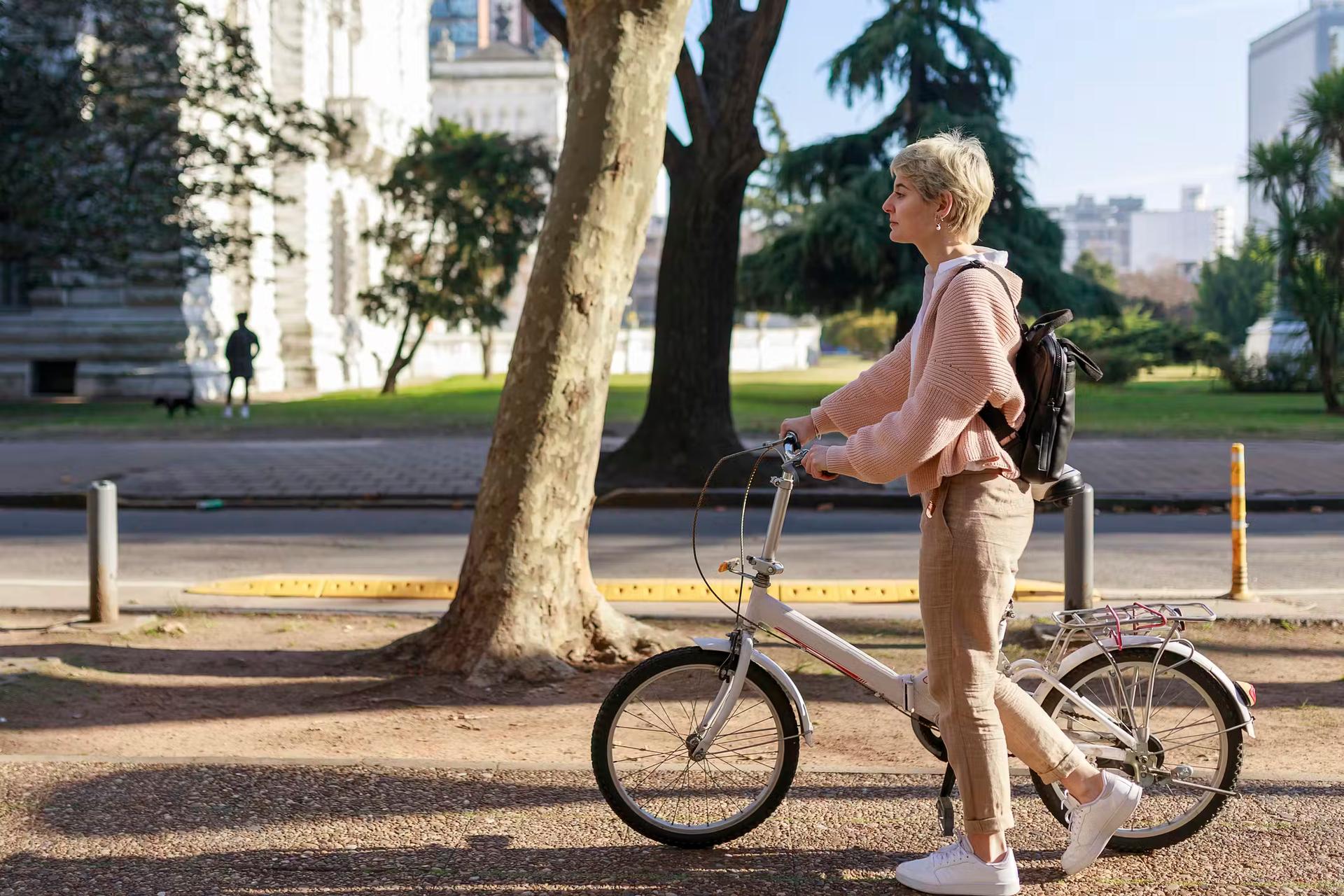 Cycling is one of the most enjoyable ways to get around Buenos Aires © Ri Fotoproducto / Getty Images
Cycling around Buenos Aires is efficient and pleasant
Cycling is perhaps the most efficient and enjoyable way to get around Buenos Aires for those confident on two wheels. The city is mostly flat and reasonably compact, and it has a network of cycle lanes that covers more than 287km (178 miles).
Most cycle lanes have a barrier to separate bikes from other traffic, but watch out for pedestrians, joggers, dog walkers and rollerbladers.
The city’s bike-share program, BA Ecobici, is free to use Monday through Friday for journeys of up to 30 minutes, up to four times a day. Download the BA Ecobici por tembici app (for iOS or Android) and create an account using your passport and a credit card.
Bicycles are released from rental stations using the Ecobici app, so you’ll need data on your phone. You can purchase a pass via the app for longer and more frequent journeys or to use a bike on the weekend. Use Cómo Llego to plan cycling routes.
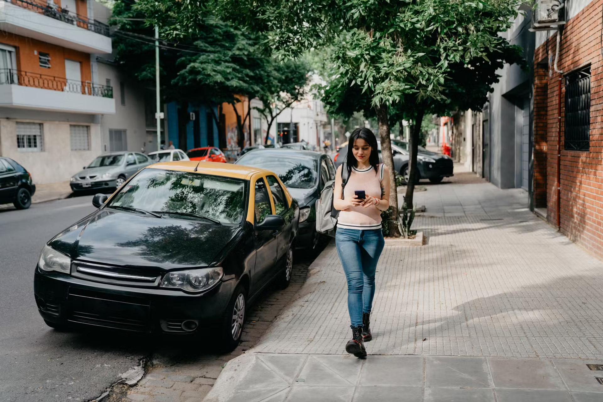 Walking the streets of Buenos Aires is a great way to explore © FilippoBacci / Getty Images
Walking is sometimes the fastest way to get around
For short distances or when traffic is bad, walking might even be quicker than taking the bus. Buenos Aires is laid out in a grid system, making it easy to navigate. Watch out for broken paving slabs on the sidewalk, especially in wet weather – step on a loose one, and your foot will be soaked.
Buenos Aires’ crowded and often narrow sidewalks can prove challenging when pushing a child’s stroller. It’s common to see babies being carried in their carers’ arms on public transit, and parents with young children might find a baby carrier or papoose easier to manage than a buggy or stroller.
Accessible transportation in Buenos Aires
Getting around Buenos Aires as a person with disabilities can be challenging and requires some planning. Buses are accessible via a ramp that the driver attaches at the rear door. However, the ramp will not always land evenly with the sidewalk, meaning not all stops are accessible. Metrobus stops are on a raised platform that is wheelchair accessible. Onboard, buses have a space reserved for wheelchairs.
A number of Subte stations are accessible via elevators from street level to the platforms. These are marked on the city government’s Subte map. Sidewalks can be crowded and uneven, but many intersections (though not all) have curb ramps. For more information on accessible travel, check out Lonely Planet’s accessible travel resources.